Angkor
A Khmer capital of temples, reservoirs and roads, slowly reclaimed from the forest.
01
Introduction
A city built around water, of which the temples are only the surviving stone
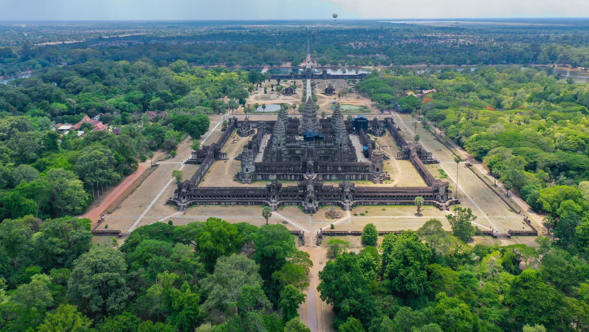
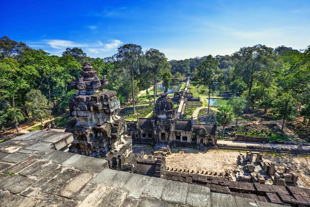
Angkor is the former heartland of the Khmer Empire, spread across about 400 square kilometres of forest, rice fields and reservoirs north of Siem Reap in north-western Cambodia. It was inscribed on the World Heritage List in 1992, which means the World Heritage Committee judged it to be of outstanding value to humanity and committed the country, with international help, to protecting it. The park holds the remains of several successive capitals, among them Angkor Wat, the walled city of Angkor Thom and the root-wrapped temple of Ta Prohm.
Most visitors arrive for Angkor Wat at dawn and share the view with a great many others who had the same idea. The more rewarding approach is to treat Angkor as a landscape rather than a single monument. Its temples were one part of a system of roads, canals and enormous reservoirs that fed a population in the hundreds of thousands, and the system is easiest to appreciate once the sunrise crowd has gone for breakfast.
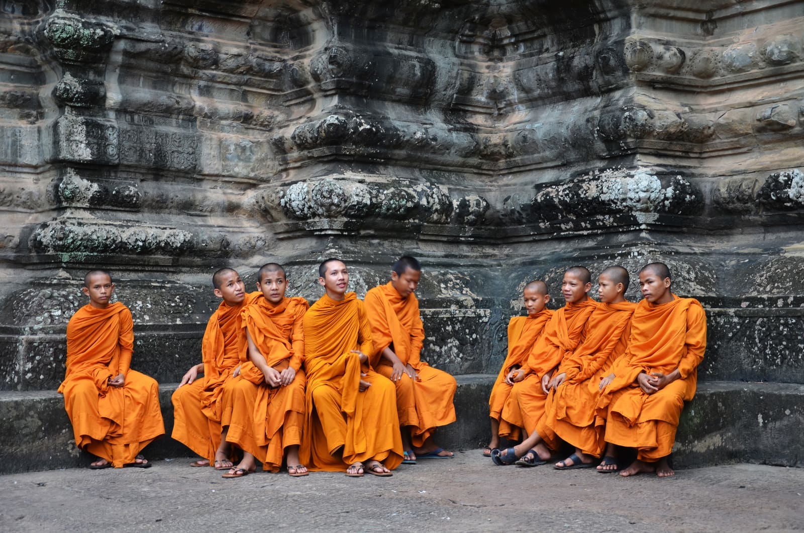
That landscape is also still alive. Monks keep Angkor Wat as a working Buddhist temple, villagers farm rice inside the park, and the carvings on the walls are read, in the present tense, as scripture and family history. A thoughtful visit holds both ideas at once: an archaeological site of the first rank, and a place that never entirely stopped being used.
02
History
Six centuries of kings, monks and engineers, and the forest that outlasted them
The Khmer Empire traces its beginnings to the early ninth century, when Jayavarman II established a kingdom on the Kulen plateau and then at Hariharalaya, near present-day Roluos. His successors moved the capital northwards, and in the late ninth century Yasovarman I founded Yasodharapura, the first city at Angkor, centred on the hill temple of Phnom Bakheng. Over the next three centuries each major king built a state temple, a reservoir or both. The pattern was deliberate: a king who dug a reservoir was feeding his people, and a king who raised a temple was founding a cult of himself and his ancestors in stone.
The tenth and eleventh centuries added some of the most refined work. Banteay Srei, finished in 967, was commissioned not by a king but by a Brahmin counsellor, which may explain its intimate scale and the extraordinary fineness of its carving. Under Suryavarman I and his successors the great West Baray, a reservoir about eight kilometres long, was dug, with a temple on an island at its centre. Water engineering was the empire's real foundation, and it made two and sometimes three rice harvests a year possible on a plain with a long dry season.
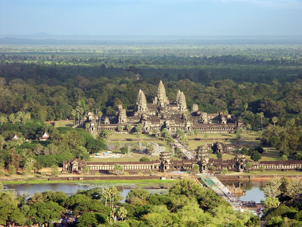
Angkor Wat was built in the early 12th century under Suryavarman II as a temple to the Hindu god Vishnu. Unusually, it faces west, the direction associated with Vishnu and, many scholars think, with the king's own funerary destiny. After a Cham invasion in 1177, which sacked the capital, Jayavarman VII drove out the invaders, took the throne and rebuilt the city as Angkor Thom. He was a Buddhist, and the Bayon, Ta Prohm and Preah Khan reflect that shift. Hindu and Buddhist imagery were later reworked and layered over each other, sometimes by chiselling one set of figures into another.
We know what the city felt like from an outsider. Zhou Daguan, a Chinese envoy, lived at Angkor in 1296 and 1297 and wrote an account of what he saw: the gilded towers, the processions of elephants, the markets run largely by women. His record, together with the inscriptions in Sanskrit and Khmer on the temples' doorposts and stelae, is the main written evidence for daily life in the capital.
The Khmer court moved away from Angkor in the 15th century, and the capital eventually settled near Phnom Penh. Why it left is still argued: invasion from Ayutthaya, shifts in trade towards the coast, a changing climate and the strain on the water system have all been proposed. Angkor was never wholly abandoned. Monks kept Angkor Wat in use as a Buddhist temple, and visitors came from far away; Japanese pilgrims in the 17th century left inscriptions there.
The French naturalist Henri Mouhot brought the site to wider European attention in 1860, though local people had never lost it. He died of fever in Laos the following year and his diary was published after his death. French scholars began systematic conservation work in the early 20th century, and in the 1920s a young André Malraux was arrested for removing carvings from Banteay Srei, a scandal that did much to publicise the temples' vulnerability. Conservation resumed in the 1990s after decades of conflict, and Angkor was inscribed in 1992 with international teams from many countries working alongside Cambodian specialists. Cambodia established the APSARA National Authority in 1995 to manage the park, and the authority remains responsible for it today.
Research since then has changed the picture again. Airborne lidar surveys from 2012, led by the archaeologist Damian Evans, mapped the ground beneath the forest canopy and revealed street grids, ponds and mounds far beyond the temple area, as well as a lost city on the Kulen plateau. The results suggest that the settlement around the temples was one of the largest pre-industrial urban areas in the world, and that archaeologists are still discovering how much of it there is to find.
03
Timeline
Eleven centuries of Khmer history, told in a dozen dates
Jayavarman II declares an independent Khmer kingdom
Yasovarman I founds Yasodharapura, the first city at Angkor
Banteay Srei is consecrated, commissioned by a royal counsellor
Suryavarman II builds Angkor Wat as a temple to Vishnu
Cham forces from the east sack the Khmer capital
Jayavarman VII takes the throne and rebuilds Angkor Thom
The Chinese envoy Zhou Daguan arrives and records life at court
The Khmer court leaves Angkor and settles further south
Henri Mouhot's writing draws European attention to Angkor
French scholars begin conservation work at the temples
Inscribed on the World Heritage List and, the same year, on the List in Danger
Cambodia creates the APSARA National Authority to manage the park
Removed from the List of World Heritage in Danger
04
Why visit
A capital whose planning, art and religion can still be read in the landscape
Most ancient capitals survive as foundations. Angkor survives as a place you can walk through for days and still not finish. Its temples are carved on a scale and with a precision that few buildings anywhere match, and the finest of them reward slow looking: the long galleries of Angkor Wat, with scenes from Hindu epics cut into the stone across hundreds of metres, are among the great works of narrative sculpture. A visit here is, among other things, a lesson in what a medieval society could do with sandstone, patience and an almost unlimited labour force.
The second reason to go is that Angkor explains itself. The temples are not scattered; they sit inside a system of causeways, moats and reservoirs that shows how a kingdom organised water, food, religion and power. Walking from a reservoir bank to a state temple, you are following the logic the Khmer kings built into the ground. That is rare. In most places you must imagine the city around the monument, whereas here a good part of it is still legible.
Third, Angkor is a record of a civilisation that is gone as an empire but alive as a culture. The inscriptions, the carved scenes of markets and wars, the shifts between Hindu and Buddhist imagery and the monks still living in the temples let you follow ideas across more than a thousand years. For a traveller interested in how beliefs and states rise and are reshaped, there are few places where the evidence is so close to hand.
Among the great ancient sites of Asia, Angkor stands out for combining all of this in one place: monumental art, an engineered landscape and living worship. Pair a day among the famous temples with a morning at a quiet outlying one, and the scale of what was built, and of what has been lost, becomes much easier to feel.
05
The setting
Flat farmland, seasonal rain and a sandstone quarry on a hill 40 kilometres away
Angkor lies on a flat plain just north of Tonlé Sap, the great lake whose water level rises and falls with the monsoon. In the wet season, from about May to October, the lake swells to several times its dry-season size and the Tonlé Sap river reverses its flow; in the dry months the plain bakes, and the temperature climbs before the rains arrive. The ancient engineers' reservoirs, canals and moats were an answer to exactly this rhythm.
The temples are built mainly from sandstone, much of it quarried in the Kulen hills about 40 kilometres to the north-east and floated or hauled to the site, and from laterite, a rust-coloured stone used for foundations and walls. Brick, used in the earliest towers, was the first medium. The forest is not an accident: tropical trees have been growing in and around the monuments for five centuries, and the park's woodland now shelters its own birds, monkeys and bats.
The park is large: roughly 400 square kilometres, with a buffer zone beyond it. The main circuit, the loop of Angkor Wat, Angkor Thom, Ta Prohm and a handful of neighbours, is about 25 kilometres round, and the outlying groups are further still. Villages and rice fields lie inside the park boundary, so the landscape is a working one. Siem Reap, the base for almost every visit, lies about six kilometres south of Angkor Wat.
Lidar, a laser survey flown from aircraft that maps the ground beneath the trees, has shown that the settled area was far larger than the temples suggest, with grids of roads, house mounds and canals extending beyond the park's core. Angkor, in other words, was a low-density city that spread over hundreds of square kilometres, and the temples are only its stone skeleton.
06
Key places
Where to spend your hours, in roughly the order most people reach them
Angkor Wat
The largest and best preserved of the temples, set inside a moat about 190 metres wide and a rectangular enclosure of more than 160 hectares. The bas-reliefs along the outer galleries run to hundreds of metres, from the Churning of the Ocean of Milk to the Battle of Kurukshetra. Go early or late; midday is hot and crowded. The central towers are climbed by a steep stair, with a queue and a dress code, so check access on the day.
Angkor Thom and the Bayon
The walled city of Jayavarman VII, entered over a causeway lined with figures holding a great serpent. At its centre, the Bayon has more than 200 serene stone faces carved on its towers, and an outer gallery of bas-reliefs that shows markets, fishing and fighting alongside the gods. The Terrace of the Elephants nearby is a good place to read the wider layout. Come in the early morning, when the light on the faces is best and the tour buses have not arrived.
Ta Prohm
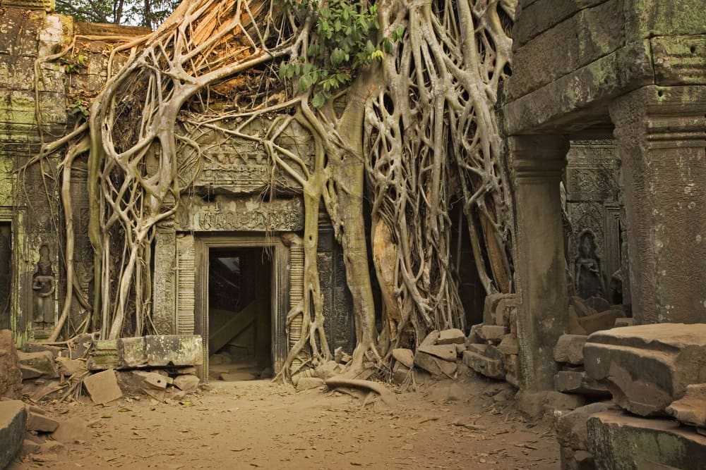
A monastery temple dedicated by Jayavarman VII to his mother and left partly in the grip of silk-cotton and strangler fig trees, which are now both a defining image and a structural problem. Walking routes are marked to protect the stonework. Expect fallen blocks and partial roofs, and allow time to walk the whole enclosure rather than stopping at the famous doorway; the quieter outer galleries are worth the extra twenty minutes.
Preah Khan and Neak Pean
Preah Khan, built by Jayavarman VII in the late 12th century, is a long, corridor-like complex that is easier to explore than most, with fewer visitors than Ta Prohm and a similar feel of trees among the stones. Nearby, Neak Pean is a small shrine on an island in a square pool, once part of a healing complex; the pool is reached by a long wooden walkway through the flooded reservoir bed, and looks best in the wet season.
Phnom Bakheng
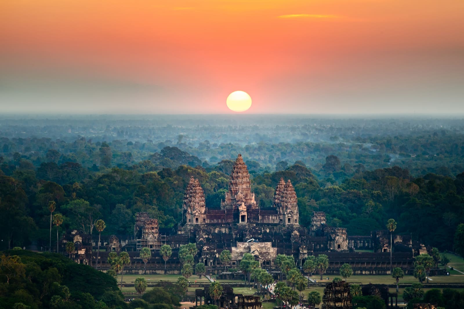
The hill temple of Yasovarman I, the centre of the first city at Angkor, built about 900. Its stepped pyramid is the traditional sunset viewpoint over the plain and the towers of Angkor Wat, and the number of people allowed at the top is limited, so expect a queue. For a quieter view, visit in the morning, when the climb is cooler and the temple almost empty, and look across the forest to the West Baray.
Banteay Srei
A small 10th-century temple of pink sandstone, about 30 kilometres north-east of Angkor Wat, known for the depth and fineness of its carving. It was the first temple at Angkor to be restored by anastylosis, the method of dismantling a building and reassembling it with its original stones, in the 1930s. It suits an early start before the heat builds and takes under an hour, which makes it a good stop on a longer day out.
Roluos group
The earliest major temples in the park, about 13 kilometres east of Siem Reap, built when the capital was still called Hariharalaya. Preah Ko and the Bakong, finished in the 870s, show how Khmer architecture began, with brick towers, early carved lintels and the first great temple-mountain in sandstone. It is quiet, rarely crowded, and rewards a morning of slow walking before lunch in the nearby villages.
07
What to expect
Heat, steps, tour groups and long stretches of surprising quiet
You will walk further than you expect. Between the temples, a day's circuit easily means eight to 10 kilometres, much of it on uneven stone and some of it up steep, narrow steps with no handrail. Wear shoes with grip, and cover your shoulders and knees at the temples; guards do check. The monumental stairs at Angkor Wat and Phnom Bakheng are steeper than they look in photographs, and descending is harder than climbing.
Crowds are densest at Angkor Wat for sunrise and at Phnom Bakheng for sunset, and thinnest in the early afternoon, when most visitors retreat to air conditioning. That is also the hottest part of the day, so there is a trade-off, and the usual answer is a long lunch. Away from the main circuit you may have a corridor to yourself. A useful rule is that anything you can reach on the small circuit by 8am will be busy, and anything an hour's drive further out will not.
Heat is the main physical challenge. Temperatures regularly exceed 35°C before the rains, humidity is high, and the stone radiates it back. Carry more water than seems sensible, and wear a hat. In the wet season the afternoon storms are short and violent, and the temples glisten and the moats fill, which many regular visitors prefer.
Touts and souvenir sellers cluster at temple entrances. A polite no is usually enough, and a smile and a no thank you works better than a long refusal. Inside the larger temples, the stone corridors are cooler than the courtyards, and you will find you are spending more time in them than planned.
The sensory memory most visitors keep is not a view but a sound: cicadas and birds in the forest, a monk chanting somewhere out of sight, the echo that gives the Bayon's galleries their odd intimacy. Allow at least one stretch of the day with no itinerary, and sit down somewhere in the shade.
08
Photographs
More of the place, as it looks on the ground
09
Planning your visit
Three days, an early start and a ticket you must keep with you
Best months
- January: best
- February: best
- March
- April
- May
- June
- July
- August
- September
- October
- November: best
- December: best
November to February
- Time needed
- Three days
- Crowding at peak
- Busy
- Access
- Entry is by Angkor Pass, available for one, three or seven days. Cover shoulders and knees at temples.
- Accessibility
- Accessibility information is limited; contact the site before travelling. Many temples involve steps and uneven stone, though some main areas can be reached by a paved path.
- Entry
- Angkor Pass: US$37 for one day, US$62 for three days and US$72 for seven days (USD). The official seller is Angkor Enterprise; see its ticket page.
- Services
- Full servicesVisitor centre, toilets, food and drink, guides and accommodation on site or within 15 minutes
Practical details checked on
Most visitors spend three days, which is enough to see the main circuit, the outer temples and a sunrise without hurrying. One day is possible but rushed, and a week is not excessive if you like to linger. Stay in Siem Reap, where the choice of rooms is wide, and arrange a tuk-tuk or car with a driver for the day rather than relying on ad hoc rides. Agree the route, the hours and the price before you set off.
Plan the days around light and heat rather than around the map. A sensible pattern is a sunrise start at one of the big temples, a late breakfast, a rest in the middle of the day and a second shift from about 3pm until closing. Save the outlying temples such as Banteay Srei, Beng Mealea or the Roluos group for a separate morning, and keep one flexible day in case rain or exhaustion wins.
A guide adds value at the bas-reliefs of Angkor Wat and the Bayon, where the carvings tell stories that are hard to follow without help, and at the Preah Khan and Ta Prohm, where the history of the restoration is part of the interest. Licensed guides can be found in Siem Reap. Buy your pass at the official ticket centre, keep it with you, and expect it to be checked at the gates of each temple.
The coolest and driest months, from November to February, are also the busiest; hotel prices rise, and the famous temples are crowded. The shoulder months of March and October trade heat or rain for space. Whatever the season, book the first night or two in advance and keep the rest flexible.
On-site services
The main temples have toilets, drink and snack sellers and shaded rest areas, and Siem Reap, about six kilometres from Angkor Wat, has hotels at every price, banks and cash machines. Mobile signal is good around the main sites and patchy on the outer circuit. Carry water: the walks between temples are longer than the map suggests.
10
Getting here
An airport east of town, a long bus from the capital and a border that is not always open
Almost everyone reaches Angkor through Siem Reap, the town about six kilometres south of Angkor Wat. The main gateway is Siem Reap Angkor International Airport, which opened in October 2023 and replaced the old airport beside the town. It lies roughly 40 to 50 kilometres east of the temples, so allow about an hour by road to reach Siem Reap and more at busy times. Flights have linked it with regional hubs such as Bangkok, Singapore, Kuala Lumpur, Ho Chi Minh City and Hanoi, as well as with Phnom Penh; schedules change often, so check what is operating before you plan.
The main overland route is from Phnom Penh, about 310 kilometres to the south-east. Buses and minivans run throughout the day and take around five and a half hours, at fares typically between about US$10 and US$17. There is no passenger train on this route at present. Many travellers also arrive by bus from Battambang, and in the wetter months, when the water is high enough, a slow boat crosses Tonlé Sap between Battambang and Siem Reap, a journey of many hours that is as much an experience as a transfer.
From Thailand, the usual overland crossing is at Poipet, about 155 kilometres from Siem Reap, followed by a taxi or bus of around three hours. Land borders between Thailand and Cambodia have been closed or restricted at times in recent years, so check the current position with both governments before you rely on one. Most visitors need a visa, and an e-visa can be applied for online through the Cambodian government's official site; check the rules for your nationality before you travel.
Once in Siem Reap, you have several ways of reaching the temples. Tuk-tuks, which here are motorcycle-drawn carriages, are the standard choice and can be hired for a day with a driver. Cars with a driver are more comfortable in the heat and rain. Ride-hailing apps operate in the town. Bicycles and electric bikes suit the flat roads around the main temples, although distances between the outer groups are long. The ticket office is on the road from Siem Reap to Angkor, and you must buy your pass there; you cannot buy one at the temple gates.
Distances to the outlying temples are larger than they look on the map: Banteay Srei is about 30 kilometres from Angkor Wat, Beng Mealea about 65 kilometres and Koh Ker, a separate World Heritage site, around 120 kilometres. Roads are paved to most of them, but journeys take longer than the distance suggests because of traffic, livestock and roadworks.
11
Local culture
A living religious landscape, not only an archaeological one
Angkor is part of the daily life of the Khmer people. Monks live and pray at Angkor Wat, Buddhist ceremonies still take place at several temples, and villages and rice fields lie within the park boundary. Most Cambodians follow Theravada Buddhism, and the temples at Angkor are where that faith meets older Hindu and ancestor-worshipping traditions. At the entrances to many temples you will see shrines with incense, flowers and fruit left by local people.
Khmer New Year, in mid-April, brings many Cambodian families to the temples to make offerings. Local belief also holds that certain places and trees are inhabited by neak ta, guardian spirits of the land, and small shrines to them stand beside many of the monuments. Visitors who ask a guide about the neak ta of a particular temple often learn more about local life than a history lecture would offer.
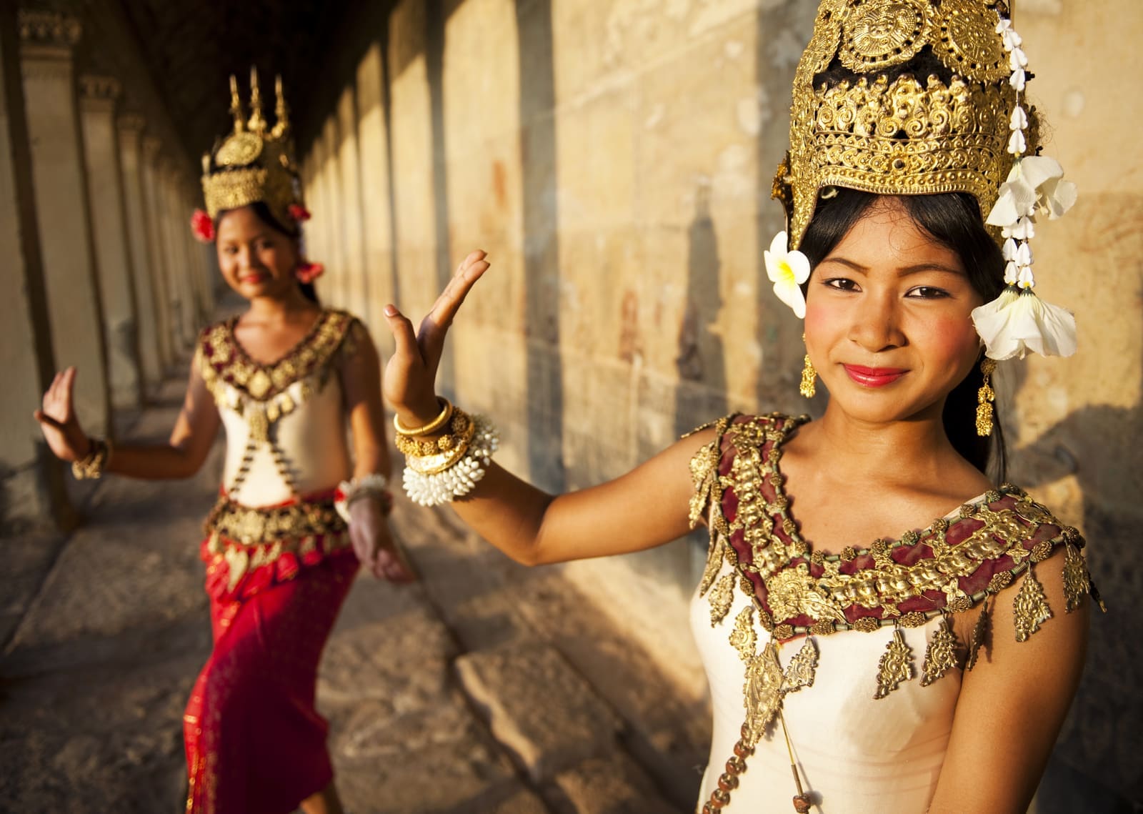
The classical Khmer dance known as apsara dance takes its name and its poses from the celestial dancers carved into Angkor's walls. It was nearly lost in the 1970s, when the Khmer Rouge killed many of its teachers and performers, and was rebuilt in the following decades by surviving dancers. Performances in Siem Reap range from careful, professionally trained productions to dinner-show adaptations, and they are worth choosing with some care. The Royal Ballet of Cambodia, which preserves the tradition, is itself on UNESCO's list of intangible heritage.
Khmer is the language of the park and its villages, and a few words of greeting are warmly received. Silk weaving, stone carving and palm-sugar production are all practised in the villages around Siem Reap, and several workshops and social enterprises train young people in traditional crafts; ask for those that sell their own work rather than imported goods.
12
Local cuisine
Fish, coconut and lemongrass, best eaten away from the temple gates
Amok is the best-known dish: fish steamed in a paste of lemongrass, galangal and turmeric with coconut cream, traditionally in a banana-leaf cup. It should be soft and almost set, rather than soupy. Lok lak is stir-fried beef with a lime and Kampot pepper dipping sauce, a good first order for anyone cautious. Nom banh chok, rice noodles in a fish-based green gravy with fresh herbs, is a breakfast dish eaten across Cambodia.
For snacks, look for num pang, the baguette sandwiches left by French rule, and for sweet things, anything made with palm sugar. Fried insects have their devotees and are sold at some night markets; the dish most adventurous visitors actually enjoy is fresh river fish grilled over charcoal. Siem Reap's night markets and the streets around them have plenty to choose from; the café culture is notably better than the temple-gate sandwich suggests.
Eat where Cambodians eat, which usually means a plastic stool, a busy kitchen and a menu on the wall. The stalls at the Old Market and the smaller markets north of the river are cheaper and often better than the restaurants beside the temples.
13
Events and festivals
Festivals here follow the Buddhist and the agricultural calendar
Mid-April
Khmer New Year (Chaul Chnam Thmey)
A three-day celebration marking the end of the harvest. Families visit temples, make offerings and play traditional games. Siem Reap is busy and some businesses close.
September or October
Pchum Ben
A 15-day festival in which Cambodians make offerings at pagodas to honour their ancestors. Many people return to their home villages, so transport is crowded.
November
Bon Om Touk (Water Festival)
Marks the reversal of the Tonlé Sap river's flow at the end of the rains, with boat races and fireworks. Crowds are large and rooms in Siem Reap book out early.
14
Challenges
Water, roots and the weight of visitors on 900-year-old stone
No significant threats to the site's World Heritage values have been raised in recent conservation reviews, though, like most popular sites, it faces the everyday pressures of visitor numbers and upkeep. Angkor was originally on the List of World Heritage in Danger from 1992, the year of its inscription, until 2004, when improvements in management and protection allowed its removal. The management challenge now is to keep that record while welcoming visitors in the hundreds of thousands, and to do it in a way that benefits the communities who live inside the park.
- Visitor numbers wear steps and floors, particularly at Angkor Wat, where timber stairways and routes now protect original stone, and where access to the upper levels has to be controlled.
- Growth in Siem Reap increases demand for groundwater, which can affect the stability of the sandy ground beneath temple foundations and the water table that supports the monuments.
- Tree roots both hold some structures together and push others apart; each tree is assessed individually, and specialists decide whether to remove, prune or leave it in place.
- Sandstone weathers in the heat and monsoon rain, and lichens and algae speed the damage if left unchecked, so cleaning and monitoring are a permanent part of conservation work.
- Development in and around the park, including hotels, roads and villages, has to be balanced against the integrity of the buffer zone and the views from the monuments.
15
Travelling responsibly
Small choices that add up in a fragile place
- Stay on marked paths and steps. Many carvings are original, and a thousand years of monsoon rain has done enough.
- Dress modestly in temples, with shoulders and knees covered, because these remain active places of worship.
- Do not climb on walls or touch bas-reliefs; skin oils darken and damage the surface of the stone.
- Hire a licensed local guide where you can, and pay a fair price, so the benefits stay in the community.
- Carry a refillable bottle and take your rubbish with you, since bins are scarce away from the main temples.
- Ask before photographing monks and local people, and do not offer money or sweets to children.
16
Frequently asked questions
The questions travellers ask most
Can you visit Angkor Wat at sunrise?
Yes, and it is one of the most popular things to do. Gates open before dawn and the crowds are large, so arrive early for a good position. Many visitors then return later in the morning, when the temple is quieter.
How many days do I need?
Three days suits most people. That gives time for Angkor Wat, Angkor Thom and Ta Prohm, plus one or two of the outer temples. One day is possible, but you will see the highlights rather than the place.
Do I need a guide?
A guide is not required, but one is useful at the Angkor Wat galleries and the Bayon, where the carvings are narrative and detailed. Licensed guides can be booked in Siem Reap.
Is Angkor suitable for children?
Yes, with planning. Children usually enjoy the causeways, the carved faces and the climbs. Steep, uneven steps are a hazard for small children, and the heat is tiring, so plan short days with a break in the afternoon.
Can I fly a drone?
Drones are restricted at Angkor, and rules can change. Check the current position with the APSARA National Authority before you bring one, and do not fly without permission.
What is the best time of year to visit Angkor?
November to February is the coolest and driest period, and the busiest. March to May is hot, and the wet season from June to October brings green landscapes, fewer visitors and afternoon storms. Plan the day around the heat in any season.
How do I get from Siem Reap to the temples?
Most visitors hire a tuk-tuk or a car with a driver for the day, which usually costs far less than a guided tour. Bicycles and electric bikes are an option around the main circuit. The Angkor Pass must be bought in advance at the ticket office.
17
Location
Siem Reap, the lake to the south and the Kulen hills on the horizon
Angkor sits on the plain north of Siem Reap, a river town that grew from a village into one of the region's busiest tourist hubs. The old centre, around the Old Market and the Siem Reap river, is where most visitors find food, markets and rooms. A string of hotels and resorts runs along the road to the temples, and the ticket office stands on that road.
To the south, about 15 kilometres away, is Tonlé Sap, the largest lake in south-east Asia, with floating and stilted villages such as Kampong Phluk. To the north-east rise the Kulen hills, the sandstone plateau that supplied the temples' building stone and is itself a place of pilgrimage. East and west, rice fields and small villages continue across the plain, with the Roluos group lying east of the town and the great West Baray, now partly dry, to the west of Angkor Thom.
Angkor is about 8 km north of Siem Reap. The nearest other World Heritage site is Koh Ker, about 80 km away.
Nearest towns and cities
- Siem Reap · about 109,000 peopleabout 8 km south
- Battambang · about 155,000 peopleabout 80 km south-west
- Sisophon · about 50,000 peopleabout 95 km west
- Pursat · about 52,000 peopleabout 100 km south
- Phnum Tbeng Meanchey · about 24,000 peopleabout 130 km east
- Aranyaprathet · about 22,000 peopleabout 150 km west
18
Around the site
Places worth the detour, and the nearest World Heritage neighbours
Tonlé Sap lake
Southeast Asia's largest lake, whose waters reverse direction each year. Floating and stilted villages around its shore, such as Kampong Phluk, show how closely local life follows the monsoon, and boat trips at the end of the day are a calm contrast to the temples.
15 km by road
Phnom Kulen
The sandstone plateau where the Khmer Empire is said to have begun, with a hilltop reclining Buddha, waterfalls that are popular with local families and a river carved with ancient lingas, symbols of the god Shiva. It is a pilgrimage place as well as a day out.
50 km by road
Beng Mealea
A large 12th-century temple, left largely unrestored and half-swallowed by the forest, about 65 kilometres east of Siem Reap. Boardwalks now guide visitors over the fallen blocks, and the long excursion usually rewards early starters with near-solitude.
70 km by road
Nearby World Heritage sites
CambodiaCultural82 km away
CambodiaCultural138 km away
CambodiaCultural143 km away
ThailandNatural219 km away
CambodiaCultural240 km away
19
Further resources
Books, links and people who know the ground
Books
- Angkor: A Cultural HistoryMichael Coe and Damian Evans, 2018
- Ancient AngkorClaude Jacques and Michael Freeman, 1999
- A Record of Cambodia: The Land and Its PeopleZhou Daguan, translated by Peter Harris, 2007
Links
Specialist travel
- Example Travel Co (TEST FIXTURE, not a real agency)Placeholder so the layout shows an agency entry; replace with a real, checked operator. · This country
The official record
- World Heritage Centre page for this sitewhc.unesco.org
- APSARA National Authorityapsaraauthority.gov.kh
- Angkor Enterprise: official Angkor Pass ticketsangkorenterprise.gov.kh
Trip reports
No one has written up a visit to Angkor yet. If you have been, we would like to hear how it went.
Been here? Share a trip reportGuest reports are credited and edited with you before they appear.
Suggest a correction or additionEvery message is read by an editor.
Last reviewed